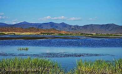
The Irtysh River is the only river which flows into the Arctic Ocean in China. It derives from the southwest slope of the Altai Mountains in north of the Keketuohai Geopark with the supplies of melt snow, melt ice, and precipitation. It forms by the confluence of Kayierte River and Kuyierte River as two sources in Holy Bell Peak. The Irtysh River rushes out of China from southeast to northwest. After such branches in the northern shore as Irtysh River, Kelan River, Buerjin River, Habahe River, Bieliezeke River feed into it along the way, it flows into Zaysan Lake in Kazakhstan and then flows north into the Arctic Ocean through the Ob River in Russia. It is generally 4,248 km in length, and 546 km in China. It covers a drainage area of 57,000 km2 and boasts an annual runoff of 11,100,000,000 m3. As its water quantity ranks only second to the Yili River in Xinjiang, the Irtysh River is the second largest river in Xinjiang. Multiple fish are yielded in the Irtysh River. The river near the Xinjiang border is up to a kilometer in width, where ships can pass through. Many branches in its drainage basin feed into it from main streams on right banks, and thus a typical pectination-shaped river system forms. As the scenery is magnificent along the bank of Irtysh River, the Irtysh River enjoys the reputation of "golden hill" and "bright silver".


