Incomparable Earthquake Remains Museum
In the early morning of
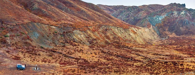
August 11, 1931, an 8.0-magnitude earthquake, known as the "Fuyun
earthquake", occurred in Kalaxiangeer, south of Keketuohai. With strong
ground shaking, the earthquake rocked places stretching thousands of
kilometers. A surface fault zone with a length of about 176 kilometers, a
strike of 342°, and a dip angle of about 70° is formed in the area from the
Keketuohai basin to the northern slope of Aermante Mount, resulting in a
horizontal displacement of 3-15 meters. The fault escarp is 0.3-5 meters high,
with some sections reaching as high as 16.5-60 meters. The Fuyun earthquake has
left behind various macro earthquake remains such as earthquake cracks,
subsidence areas, earthquake rift troughs, and offset streams, as well as micro
earthquake remains such as earthquake scarps, earthquake eyebrow ridges,
landslides, ridges, trenches, fault sag ponds, bulges, dislocated talus, and
earthquake rupture. Although more than 90 years have passed, these ancient
earthquake remains are well preserved due to favorable natural conditions.
These earthquake remains can be said to be a unique earthquake remains museum
in the world, attracting visitors around the globe.