- Felt house,Museums on the Move
- Beautiful Folk Village - Talat Village
- The Irtysh Grand Canyon
- No.3 Mine:Development of green mines
- What you must know about the Keketuohai mini...
- Escape the city and cross the Keketuohai
- Partners help geopark tourism development
- Fuyun Airport officially launched the Fuyun-...
- Taste the nomadic life in Sayiheng Bulake Su...
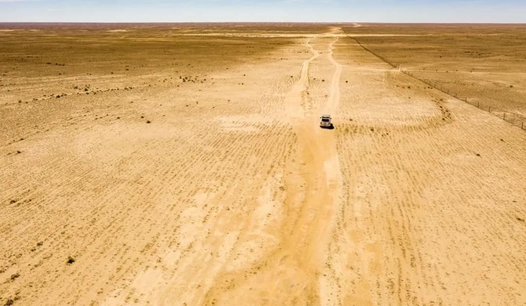
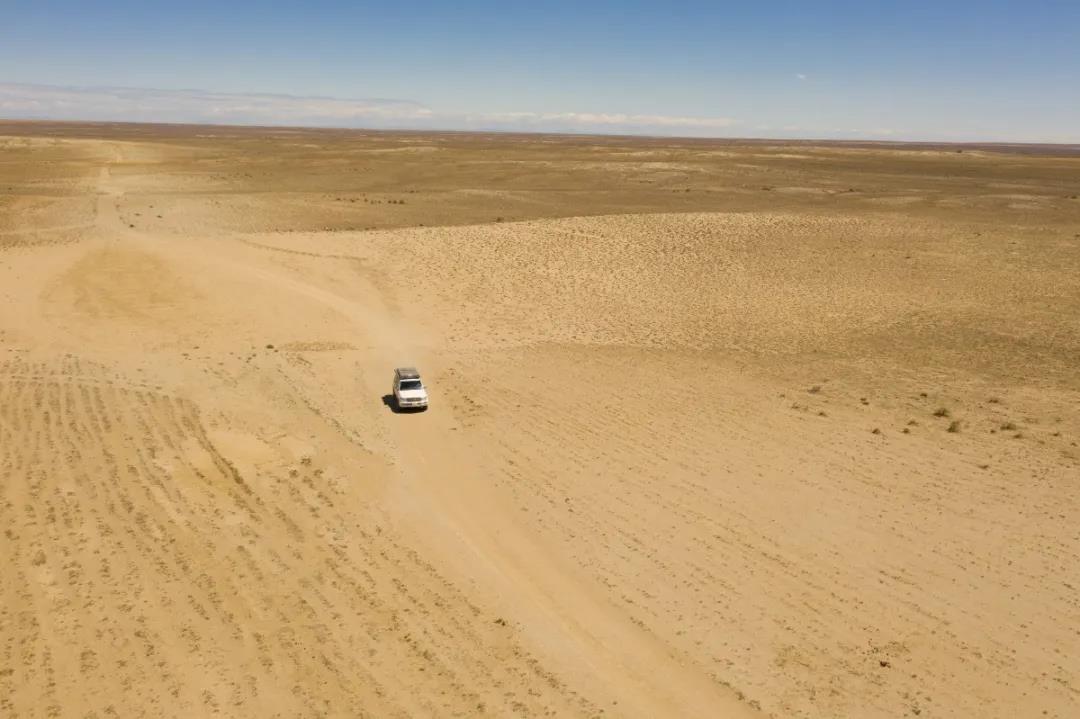
Gobi landform
The Gobi Desert is one of the world's great desert and semi-desert regions, stretching across the vastness of Central Asia and across the vastness of Mongolia and China. Most of the Gobi is not desert but bare rock.
Several of China's major, large deserts and sandy areas are located mainly in Xinjiang, Inner Mongolia, Gansu and Ningxia, with a total area of 712,900 square kilometres of deserts (including sand dunes and wind-eroded land) and 569,500 square kilometres of the Gobi, accounting for 13.36 per cent of the country's surface area, of which Xinjiang's deserts cover a total area of 420,000 square kilometres and the Gobi covers an area of 293,000 square kilometres, placing it at the The total area of deserts in Xinjiang is 420,000 square kilometres, and the area of Gobi is 293,000 square kilometres, ranking the first in the area of deserts and Gobi in the country.
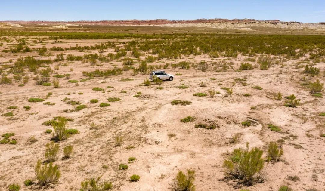
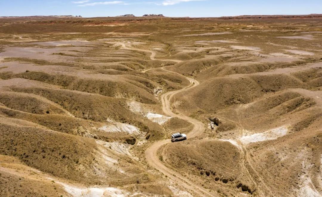
Most of Xinjiang's Gobi is plain-like, spreading out endlessly. The Gobi is a combination of gravel and earth, washed, crashed, cut and broken by floodwaters and rocks coming down from the mountains over millions of years. Although it looks flat, cars can't go very far on it because the knife-like pieces of gravel will quickly cut up the tyres.
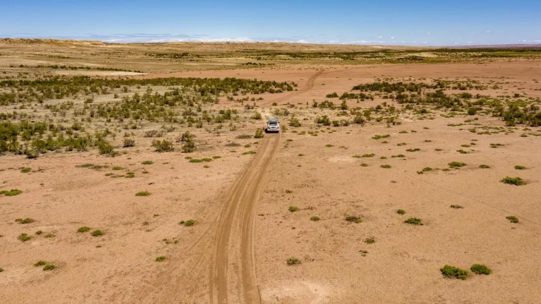
The most common plant in the Gobi is the pike, and the pike tree is also the ecological protector of desert areas. It is drought-resistant, heat-resistant, cold-resistant, saline and alkali resistance are very strong, stem and branch salt content of up to 15% or so, light-loving, intolerant of shade, adaptable, fast-growing, dense branches, well-developed root system, wind and sand-fixing ability, is China's northwestern and Inner Mongolia, arid desert areas of the sand-fixing and afforestation of the excellent tree species.
Shuttle tree is not only extremely strong ability to survive, but also has its developed root system. In order to absorb as much water as possible around the pike tree, its root system can be fully extended to a very deep and wide place. While absorbing water, these densely packed roots incidentally grab the soil around them, thus reducing soil loss.
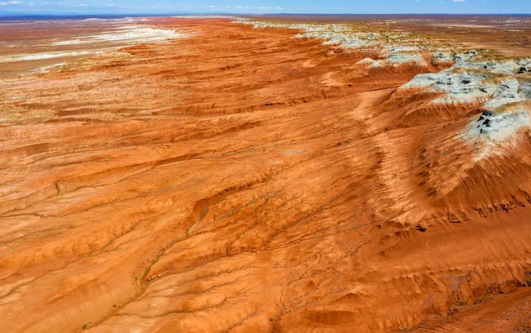
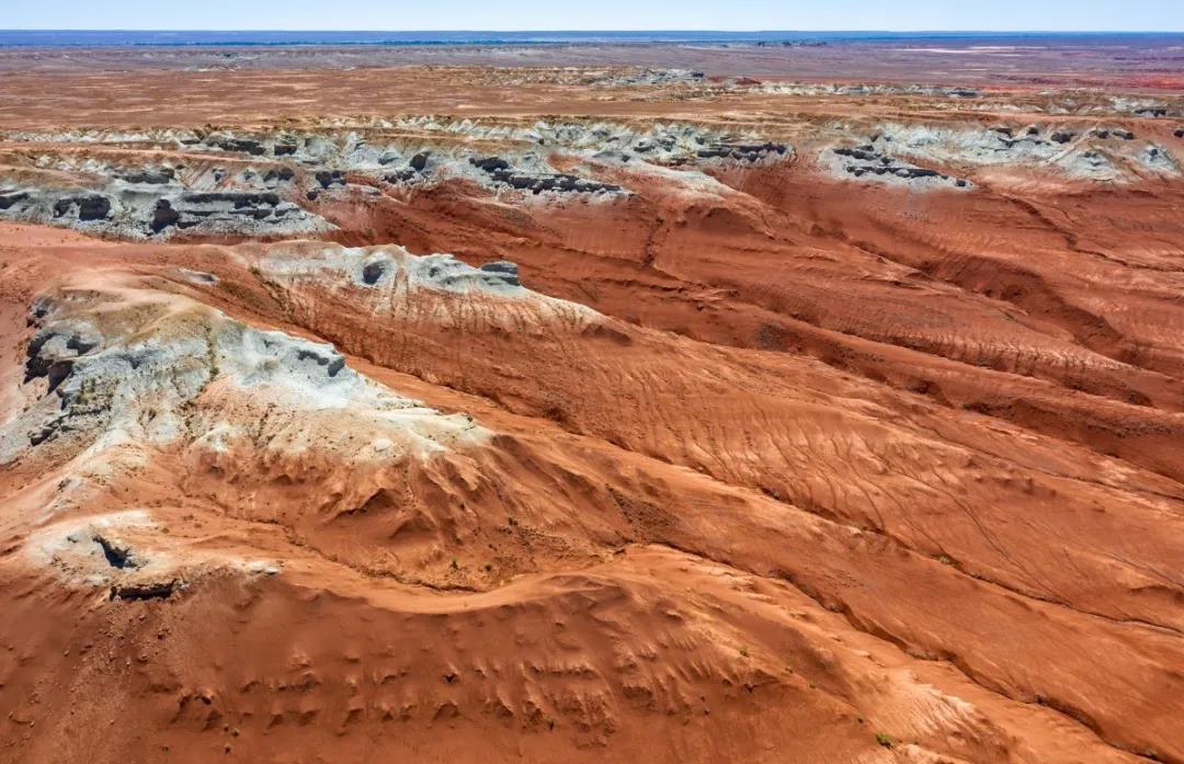
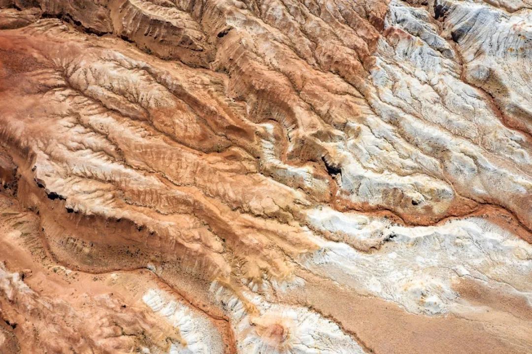
Coloured mounds and Danxia landforms
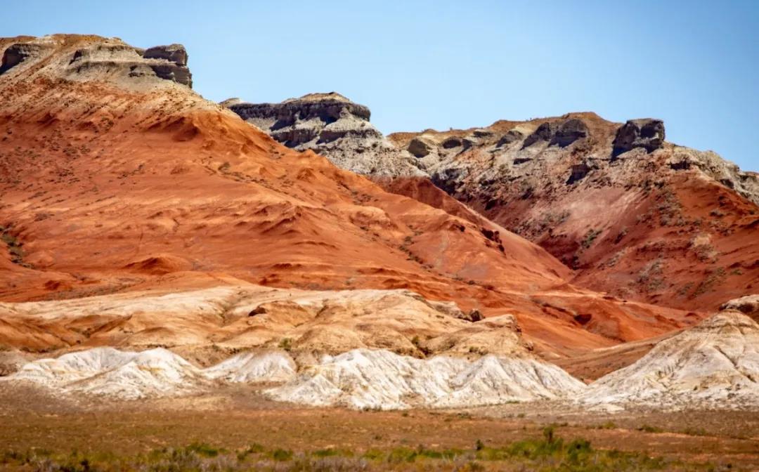
Danxia landforms must have two basic conditions: first, there must be steep cliff slopes, the so-called "red cliffs". Secondly, the material basis must be red terrestrial clastic rocks, where red is relative, no matter how many other colours this red is mixed with: brown, purple, orange, brown-yellow, grey-purple, white, grey, green, yellow, black ...... As long as the macro is still dominated by the red, the people's visual perception is red; terrestrial is that these rocks are deposited in the inland river and lake basins; clastic rocks are those made up of large and small rocks, which is the most important part of the Danxia landforms. inland river and lake basins deposited; clastic rocks are those rocks composed of sandstone particles of varying sizes, such as sandstone, conglomerate, breccia, etc.
Danxia geomorphology is characterised by red cliffs, which look like layers of red city and slices of cloud, with the reputation of "colour as Wodan, brilliant as bright sunshine". Most of the adult Danxia geomorphological area is a peak forest, peaks and clusters, rocks and stones of different heights, in order, different forms, weather.
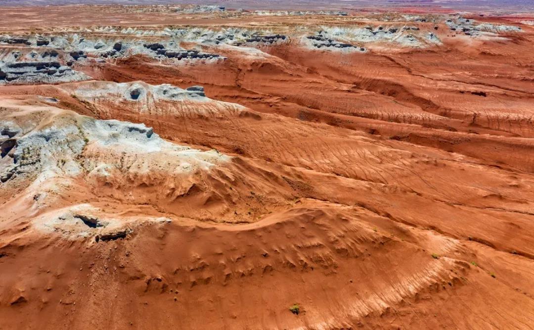
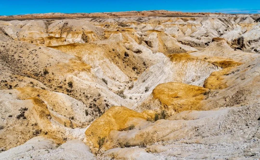
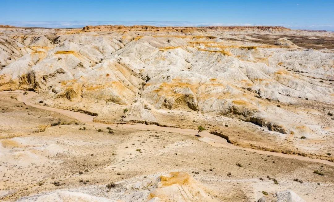
Coloured hills (referred to as "coloured hills") is a geomorphological term that has emerged only in the past two years, and its study is still in its infancy.
Coloured mounds are hilly and heterochromatic rocky landforms formed by a variety of factors, and they are called coloured mounds because of their colourfulness. The concept of coloured hills also has two levels of meaning: one is to have a hilly form; the second is that the rock layers show rich colours. The more representative distribution sites include Zhangye Coloured Mounds in Gansu, Wucaiwan in Xinjiang Changji Hui Autonomous Prefecture, Wucaitan and Wucaicheng in Xinjiang Altay Region, and Fuyun County in Xinjiang.
The colourful mounds attract people's eyes with the combination of variegated colours and undulating waves, and have become a geomorphic landscape that is quite popular among tourists.
Strictly speaking, colourful hills and Danxia landforms are developed on the same type of rock formation, which is called "red layer" by scholars.
Yardang landform (formed by wind erosion)
Yardang landform is a kind of relatively weak lake sediment eroded by the wind into parallel grooves and ridges of landforms, called "Yardang" in Viennese, which means "steep mounds".
Firstly, morphologically, Yardang is a basically parallel distribution of grooves and ridges, i.e., a groove, a ridge, the distribution of each other; secondly, the material basis for the formation of Yardang is not yet rocky lake sediments.
Yardang distribution area is often in the dry area of the arid zone not long ago dried up salt water lake basin, sediments containing a large number of salts, these salts that become sediment cementation. Due to the dry climate, the water is reduced, the lake shrinks and dries up, the strong wind wrapped in sand erosion of the ground, in the lake sediments above the erosion of a groove, between the grooves will be left parallel to the long ridge-like highlands. Therefore, the direction of these grooves and ridges also reflects the prevailing wind direction in the area.
When you look at the Yardang landforms from afar, it seems like a thousand sails on the Gobi Beach, but in fact, they are all steep earth beams, some of which are up to a hundred or even a thousand metres long, and some of them have been divided into isolated mounds. Some Yadan landforms look like the Great Wall of earth, ancient castles, some are like ocean-going giant ships or long trains, some are like pavilions or animal modelling, a thousand shapes and forms, very spectacular, giving a person a mysterious and mysterious, a sense of wonder and wonder.