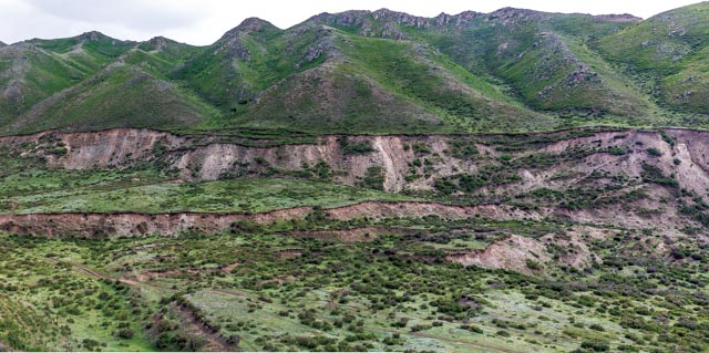
Ladder-shaped Earthquake Scarp
The altitude is 1,880m.The scarp is 0.2-0.5m high with
different extending lengths, distributing at the west side of the main fault of
Fuyunearthquake fault zone. It is vertically and horizontally intertwined in
the shape of ladder. It can be generally divided into three groups:NNW, nearly
SN,NEE-EW direction. The width of the distribution range is about 350m. It is a
linear scarp or escarpment composed by a free surface tending to the downthrown
side because ofthe different elevation and subsidence movement on both sides of
the earthquake fault and the seismic surface rupture zone. It belongs to the earthquake
microtopography.