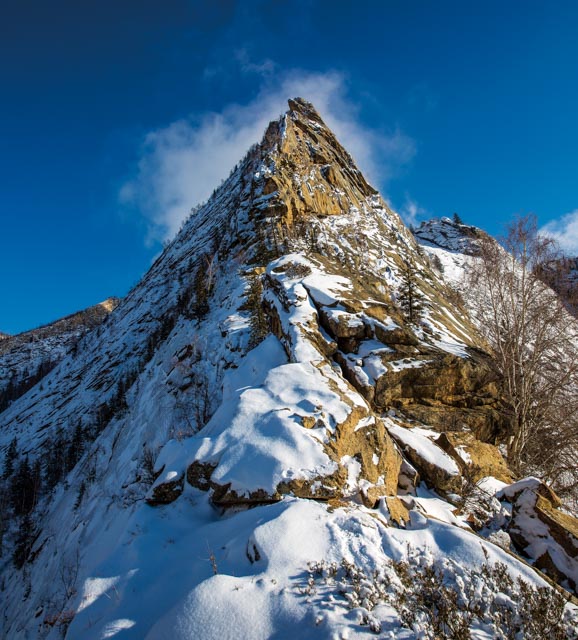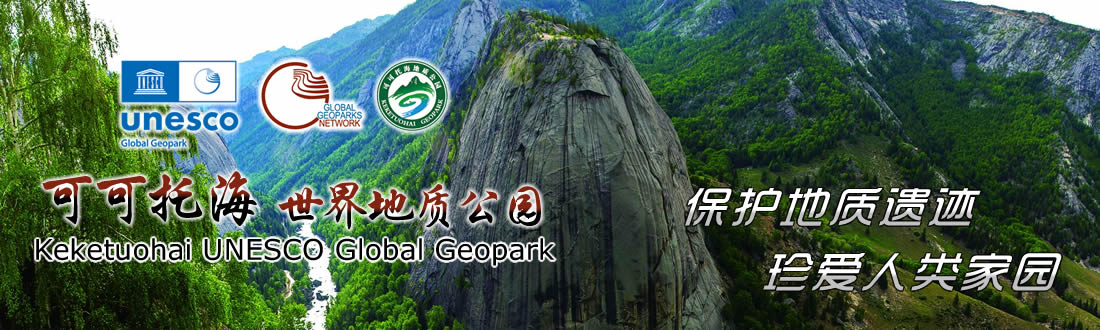
Sword Peak
The altitude is 1,340 m. The peak is about 10 m wide,
and the slope angle is 60° ~ 75°, with joints developed at the surface of the
slope. The whole body is in a triangular pyramid shape with the gentle bottom
and the steep peak. The relative height difference is 160 m, and the pyramidal
tip upward meets the cloud, just like a sharp sword full of momentum. It is the
pyramidal granite landform formed by
the gray medium-grained granite of the Middle Variscan periodthrough collapsingalong
the joint surface under the weathering.