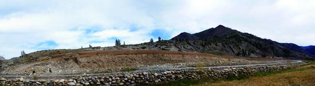
Terraces
The
altitude is 1,248 m. It is about 800 m in length and 2 m in hight. The terrace
is 1 m to several meters higher than the riverbed, mainly exposing the gravel
layer and moraine layer in Pleistocene. The gravel diameter is not of uniform
size, generally 10-30 cm. The river valley is eroded to be the broad valley and
accumulated with alluvial deposit.Thereafter, due to crust upliftor climate
change and strong down-cutting action, the ladder-like terrain higher than the
riverbed and distributed along the bank is formed. It owns typical dualistic
structure; that is to say, the lower part of the riverbed sediment is coarse
sand and gravel, and the upper part is fine sand or clay soil.