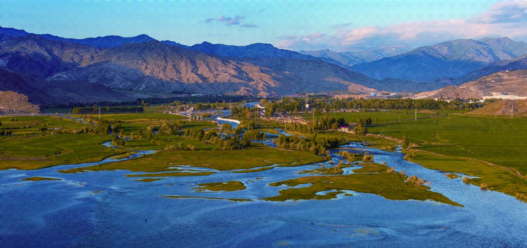
Yileimu Lake
The altitude is 1,710m.In Kazakh, the meaning of Yileimu is "swirl".It locates at the confluence of Irtysh River and its tributary KayierteRiver.The lake is 7.5km long in south-north direction and 4.5km wide in east-west direction,with water storage of 113 million m3.It is a reservoir-type lake formed by a fault basin in the Fuyun seismic fracture zone after damming rivers.The formation of lake basin benefits from the multiple dislocated accumulations in the Fuyun seismic fracture zone.A ladder-shaped normal fault can be seen on the west bank of the Yileimu Lake.